
Ban Don Yang
Location
Nonglu Sub-district, Sangklaburi District, Kanchanburi Province
Distance from Border
Less than 1 km
Distance from Sangklaburi
31 km / approx. 1 hour driving time (through the village of Huai Malai)
Distance from Bangkok
430 kms / approx. 6 hours driving time
Accessibility
Car: All-year-round access; requires 4WD in rainy season
Phone: Mobile phone coverage only behind the “Or Sor” checkpoint at camp entrance.
Camp Geography
Area 70 acres (11 ha)
Introduction and History
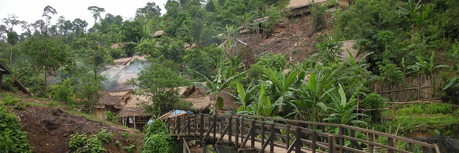
Ban Don Yang is a relatively small camp with some 2,700 residents, of whom more than 95 percent are of Karen/Kayin ethnicity.
More than 70 percent of residents are from Tenerassim/Tanintharyi Region in Burma/Myanmar, with 22 percent from Karen/Kayin State and around 5 percent from Mon State.
The camp was formed in May 1997 as a result of a consolidation of two former sites following offensives that year in Tenasserim/Tanintharyi Region and Dooplaya District of Karen/Kayin State.
Initially, living conditions were very rudimentary, with plastic sheeting for roofing and lack of adequate space between dwellings. Nowadays, houses have more suitable grass thatch roofs.
The camp lies directly opposite the Mon resettlement site of Halockhani—a collective name for an area consisting of five resettlement sites.
Due to its isolated location, the camp is off the mains electricity grid. The camp office and health and education centres have access to power from electric generators. Some households also have access to these to recharge vehicle batteries to power residential lighting.